Texas Offshore Miocene Project, Task 11
Well Bore Management
Sandia Technologies, LLC leads the Task 11 effort, which involves the identification of wells drilled in the Texas State and US Federal waters in the area located offshore of Brazoria County in a region generally referred to as the San Luis Pass Salt Dome area.
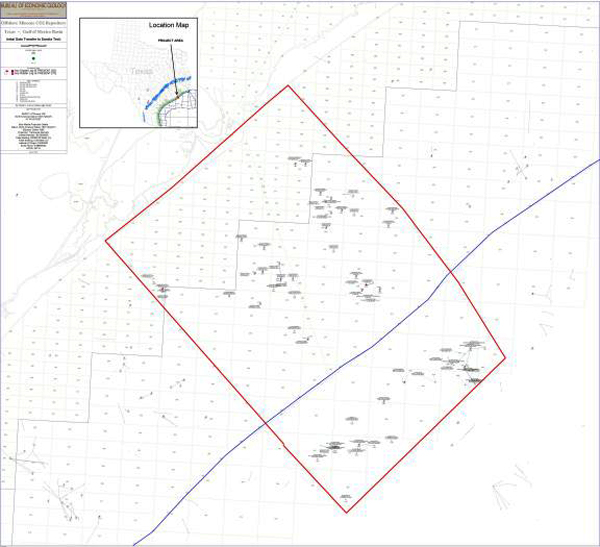
The map below identifies 37 well locations in state waters and 25 well locations in the federal waters. The blue line is the boundary between State and Federal waters. State of Texas waters are to the northwest and Federal OCS (offshore continental shelf) waters to the southeast of the boundary.
Sandia contracted DB Associates of Austin, Texas, a specialty research company, to obtain well logs and associated records for each well shown in the map below from the Railroad Commission of Texas and the US Bureau of Ocean Energy Management (BOEM). DB Associates located logs for 29 wells located in state waters and drillings records for 36 wells. Sandia will consider other options for locating the remaining logs and drilling record.

In Federal waters, 19 well locations, and potentially a total of 22, were identified. Well logs and drilling records were requested from the BOEM for all of these wells. A total of 23 drilling records packages were provided, but no well logs were made available. Sandia suspects that duplicates are contained in the records provided by the BOEM, but this has not yet been definitively determined as the data packages have yet to be reviewed. Sandia will consider other options for obtaining copies of the missing well logs and drilling records. The most likely candidates for sourcing the missing data are commercial geologic data libraries.
Sandia continues to catalogue records received. Seventeen well records for wells drilled in state waters have been matched to corresponding well logs. Nineteen drilling records are yet to be matched to their corresponding well log. Records of wells drilled in federal waters have not yet been catalogued. Duplicate logs and drilling records are being removed as work progresses.
Data for 14 wells have been summarized and reviewed. Evaluation of well construction is challenging because information within the drilling records and the well logs is not always consistent. Drilling records are filed over time and documentation is not always complete.
<< Back to Texas Offshore Miocene Project main page || << view previous Task


