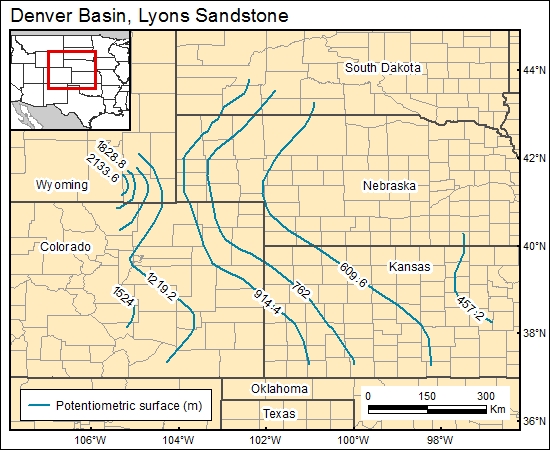
Lyons Sandstone, Denver Basin (11)
Comments on Geologic Parameters
11 Flow Direction:
The hydraulic potential and the modeled flow regime in the underlying Fountain Formation (Lee and Bethke, 1994) show that fluids in the Fountain Formation flow along the basin's axis. As the Fountain flowpath pinches out, brine discharges upward into the Lyons, mixes with ground waters, and then migrates to the east. The potential simulated map added to the GIS data base of the Triassic-Permian unit by Belitz and Bredehoeft (1988) also shows flow movement to the east.
11 Map:

11 Reference:
Belitz, K., and Bredehoeft, J., 1988, Hydrodynamics of Denver Basin: explanation of subnormal fluid pressures: American Association of Petroleum Geologists Bulletin, v. 72, no. 11, p. 1334–1359.
Lee, M. L., and Bethke, C., 1994, Groundwater flow, late cementation and petroleum accumulation in the Permian Lyons Sandstone, Denver Basin: American Association of Petroleum Geologists Bulletin, v. 78, no. 2, p. 227–237.


