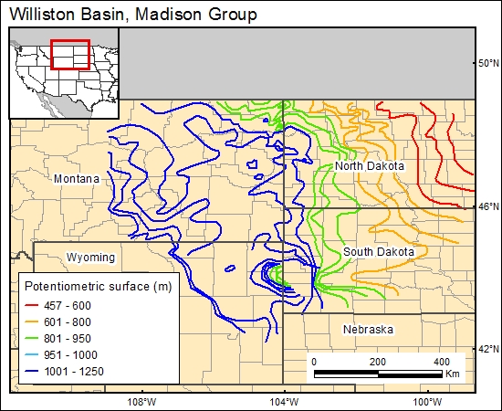
Madison Group, Williston Basin (11)
Comments on Geologic Parameters
11 Flow Direction:
The final potentiometric map by Downey (1986) and used in this project was the result of a detailed analysis also using the previous potentiometric maps contoured for the Madison Group by Miller and Strausz (1980, in Downey, 1986).
11 Map:

11 Reference:
Downey, J. S., 1986, Geohydrology of bedrock aquifers in the northern Great Plains in parts of Montana, North Dakota, South Dakota and Wyoming: U.S. Geological Survey Professional Paper 1402-E, 87 p.
Downey, J. S., 1984, Geohydrology of the Madison and associated aquifers in parts of Montana, North Dakota, South Dakota and Wyoming: U.S. Geological Survey Professional Paper 1273-G, 47 p.


