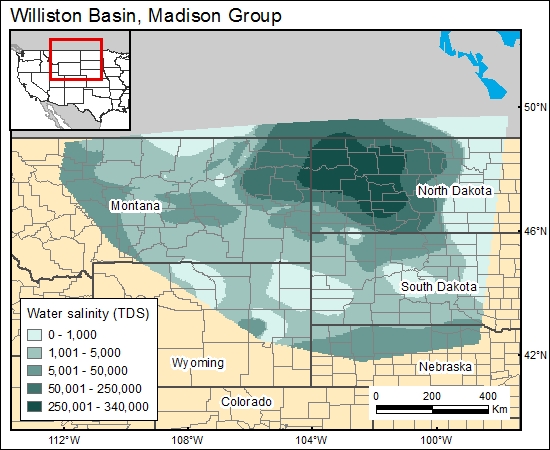
Madison Group, Williston Basin (12c)
Comments on Geologic Parameters
12c CO2 Solubility Brine: Formation Water Salinity:
Water in the area varies significantly in dissolved solids concentration and in temperature, and the density and viscosity vary from area to area. The highest TDS concentrations of about 10,0000 to 300,000 mg/L are on the northeast side of the basin, as shown in the concentration of dissolved solids on the GIS map by Busby (1981, in Downey, 1984, 1986).
12c Map:

12c Reference:
Downey, J. S., 1986, Geohydrology of bedrock aquifers in the northern Great Plains in parts of Montana, North Dakota, South Dakota and Wyoming: U.S. Geological Survey Professional Paper 1402-E, 87 p.
Downey, J. S., 1984, Geohydrology of the Madison and associated aquifers in parts of Montana, North Dakota, South Dakota and Wyoming: U.S. Geological Survey Professional Paper 1273-G, 47 p.


