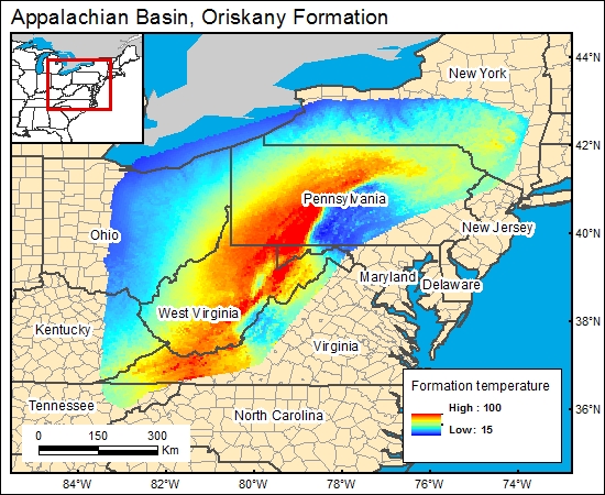
Oriskany Formation, Appalachian Basin (12a)
Western Pennsylvania, Eastern Ohio, and Eastern Kentucky
Comments on Geologic Parameters
12a CO2 Solubility Brine: Formation Temperature:
Opritza (1996) and Patchen and Harper (1996) provided temperature versus depth data for the Oriskany Sandstone of the central Appalachian Basin. We plotted their data, which formed a definite gradient such that 63 + 0.0092 Depth = formation temperature (in °F). To derive a temperature-distribution map for the GIS, the temperature gradient at formation depth was calculated (c12oriskanyg).
12a Map:

12a Reference:
Opritza, S. T., 1996, Play Dop: the Lower Devonian Oriskany Sandstone updip permeability pinchout, in Roen, J. B., and Walker, B. J., eds., The atlas of major Appalachian gas plays: West Virginia Geological and Economic Survey Publication V-25, p. 126-129.
Patchen, D. G., and Harper, J. A., 1996, Play Doc: the Lower Devonian Oriskany Sandstone combination traps play, in Roen, J. B., and Walker, B. J., eds., The atlas of major Appalachian gas plays: West Virginia Geological and Economic Survey Publication V-25, p. 118-125.


