Arbuckle Group, Oklahoma (08)
Comments on Geologic Parameters
08 Continuity of Top Seal:
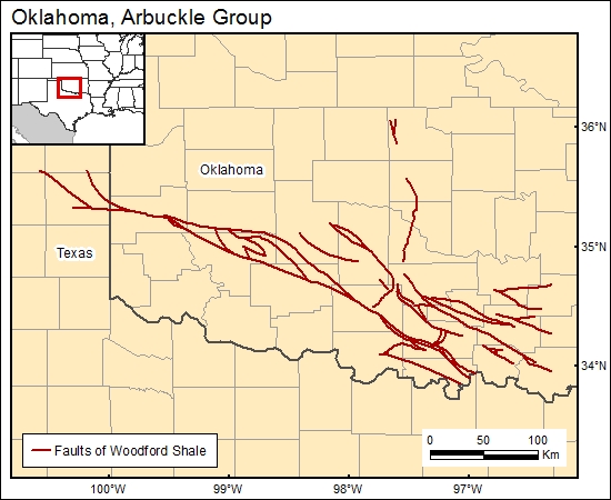
We digitized the faults from Amsden's (1975) isopach map of the Woodford Shale as a means to define the continuity of the unit.
08 Map:

08 Reference:
Amsden, T.W., 1975, Panel 4-Isopach map of Woodford Shale, in Hunton Group (late Ordovician, Silurian, and early Devonian) in the Anadarko Basin of Oklahoma: Oklahoma Geological Survey Bulletin, v 121,214 p.


