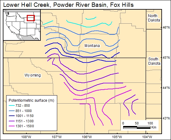
Fox Hills, Lower Hell Creek, Powder River Basin (11)
Comments on Geologic Parameters
11 Flow Direction:
Flow directions inferred from potentiometric contour maps of the Fox Hills Sandstone in the northeast part of the Powder River Basin were documented by Henderson (1985). These inferred flow paths are north and northwestward. However, these maps represent only a limited part of the basin.
11 Map:

11 Reference:
Henderson, T., 1985, Geochemistry of ground-water in two sandstone aquifer systems in the northern Great Plains in parts of Montana and Wyoming: U. S. Geological Survey, Professional Paper 1402-C, p. C1-C84.


