Fox Hills, Lower Hell Creek, Powder River Basin (05)
Comments on Geologic Parameters
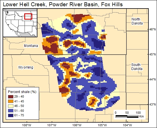
05 Percent Shale:
Percent shale of the Fox Hills Sandstone is directly inferred from the percent-sandstone map of Lewis and Hotchkiss (1981). Greatest percent-shale values occur in the south part of the basin.
05 Map:
05 Reference:
Lewis, B. D., and Hotchkiss, W. R., 1981, Thickness, percent sand, and configuration of shallow hydrogeologic units in the Powder River Basin, Montana and Wyoming: U. S. Geological Survey, Miscellaneous Investigations Series, Map I-1317, 6 sheets.


