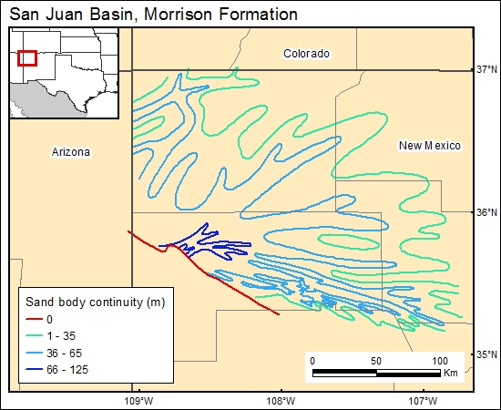
Morrison Formation, San Juan Basin (06)
Comments on Geologic Parameters
06 Continuity:
The continuity of the Morrison aquifer can be estimated from the sandstone isolith map of Galloway (1980), in addition to the outcrop patterns and faults on the edge of the basin. These fluvial sandstones are highly heterogeneous.
06 Map:

06 Reference:
Galloway, W. E., 1980, Deposition and early hydrologic evolution of the Westwater Canyon and other fluvial fan systems, in Rautman, C. A., compiler, Geology and mineral technology of the Grants uranium region: New Mexico Bureau of Mines and Mineral Resources Memoir 38, p. 59–69.


