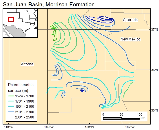
Morrison Formation, San Juan Basin (11)
Comments on Geologic Parameters
11 Flow Direction:
The flow of fluids in the Morrison aquifer is generally from the recharge areas rimming the San Juan Basin toward the center of the basin (Dam and others, 1990).
11 Map:

11 Reference:
Dam, W. L., Kernodle, J. M., Thorn, C. R., Levings, G. W., and Craigg, S. D., 1990, Hydrogeology of the Morrison Formation in the San Juan structural basin, New Mexico, Arizona, and Utah: U.S. Geological Survey, Hydrologic Investigations Atlas, HA-0720-J, 2 sheets.


