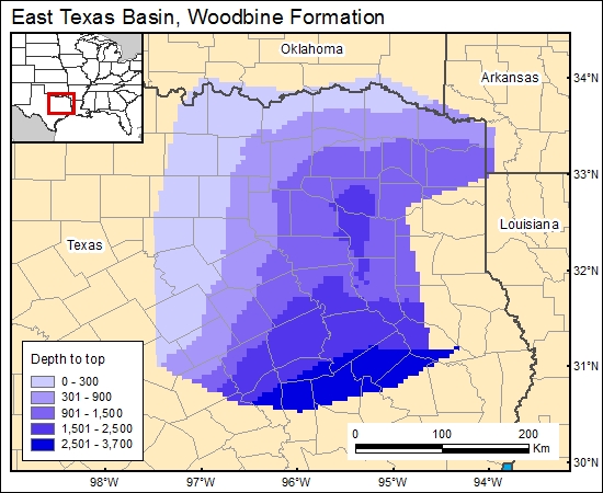
Woodbine Formation, East Texas Basin (01)
Comments on Geologic Parameters
01 Depth:
Structure on top of the Woodbine was digitized from Core Labs (1972). Contours were gridded by using the Grid algorithms in ARC/INFO, and depth below land surface was calculated by using the U.S. Geological Survey digital elevation model (c1woodbineg). A more detailed, large, plate-size structure map was presented by Calavan (1985).
01 Map:

01 Reference:
Core Labs (Texas Water Development Board), 1972, A survey of the subsurface saline water of Texas: Texas Water Development Board, Report 157, v. 1, 113 p.


