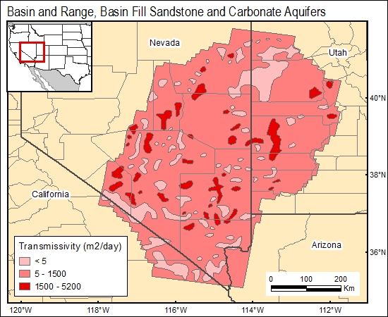
Basin Fill Sandstone and Carbonate Aquifers, Basin and Range (02)
Go back to the Brine Database homepage
Arizona, Nevada, and California
Comments on Geologic Parameters
02 Permeability/Hydraulic Conductivity:
Simulated transmissivity values, from which permeability is inferred, were presented for carbonate aquifers in Nevada by Prudic and others (1985). The distribution of low-permeability consolidated rock, including tuff layers and intrusive bodies was shown by Harrill and others (1988).
02 Map:

02 Reference:
Harrill, J. R., Gates, J. S., and Thomas, J. M., 1988, Major ground-water flow systems in the Great Basin region of Nevada, Utah, and adjacent states: U.S. Geological Survey Hydrologic Investigations Atlas HA-694-C, scale 1;1,000,000, 1 sheet.
Prudic, D. E., Harrill, J. R., Burbey, and Thomas J., 1995, Conceptual evaluation of regional ground-water flow in the carbonate-rock province of the Great Basin, Nevada, Utah, and adjacent states: U.S. Geological Survey Professional Paper P-1409-D, 102 p.


