Basin Fill Sandstone and Carbonate Aquifers, Basin and Range (12c)
Arizona, Nevada, and California
Comments on Geologic Parameters
12c CO2 Solubility Brine: Formation Water Salinity:
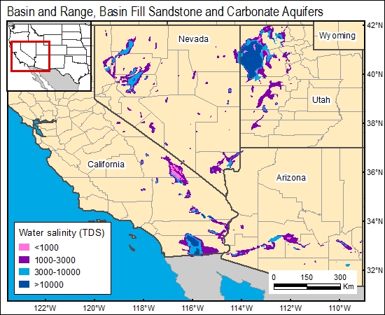
Formation-water salinity data for Tertiary basin-fill aquifers are provided in Robson (1996) and the U.S. Geological Survey (1996). Concentrations of greater than 3,000 ppm of total dissolved solids are limited to elongate, fault-bounded areas.
12c Map:
12c Reference:
Planert, M., 1996, Ground water atlas of the United States, Segment 1: California and Nevada: U.S. Geological Survey Atlas.
U.S. Geological Survey, 1996, Ground water atlas of the United States, Segment 1.


