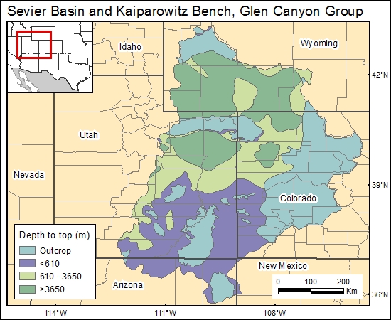
Glen Canyon Group, Sevier Basin and Kaiparowitz Bench (01)
Comments on Geologic Parameters
01 Depth:
The principal sources for inference of formation depth of the Glen Canyon Group are Freethey and Cordy (1991) and Freethey and others (1988). A generalized map of formation-depth ranges in polygon format was provided by the U.S. Geological Survey (1996).
01 Map:

01 Reference:
Freethey, G. W., and Cordy, G. E., 1991, Geohydrology of Mesozoic rocks in the Upper Colorado River Basin—excluding the San Juan Basin - in Arizona, Colorado, New Mexico, Utah, and Wyoming: U.S. Geological Survey, Professional Paper 1411-C, 118 p.
Freethey, G. W., Kimball, B. A., Wilberg, D. E., and Hood, J. W., 1988, General hydrogeology of the aquifers of Mesozoic age, upper Colorado River basin - excluding the San Juan Basin—Colorado, Utah, Wyoming, and Arizona: U.S. Geological Survey, Hydrologic Investigations Atlas HA-698, scale 1:2,500,000, 2 sheets.
U.S. Geological Survey, 1996, Ground water atlas of the United States: Segment 2: Arizona, Colorado, New Mexico, and Utah.


