Glen Canyon Group, Sevier Basin and Kaiparowitz Bench (07)
Comments on Geologic Parameters
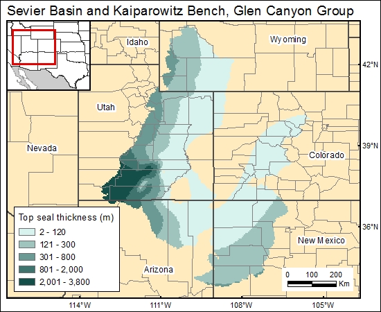
07 Top Seal Thickness:
The most detailed maps of top-seal thickness (isopach of the Carmel–Twin Creek confining unit) were presented by Freethey and Cordy (1991). However, their map covers only the east half of Utah and does not include the Sevier Basin. Regional maps of the Carmel Formation (Kocurek and Dott, 1983), however, suggest that the top seal is equally thick in western Utah.
07 Map:

07 Reference:
Freethey, G. W., and Cordy, G. E., 1991, Geohydrology of Mesozoic rocks in the Upper Colorado River Basin—excluding the San Juan Basin—in Arizona, Colorado, New Mexico, Utah, and Wyoming: U.S. Geological Survey, Professional Paper 1411-C, 118 p.
Kocurek, G., and Dott, R. H., Jr., 1983, Jurassic paleogeography of the central and southern Rocky Mountains region, in Reynolds, M. W., and Dolly, E. D., eds., Mesozoic paleogeography of the West-Central United States: Rocky Mountain paleogeography symposium: Denver, Rocky Mountain Section, Society of Economic Paleontologists and Mineralogists, v. 2, p. 101–116.


