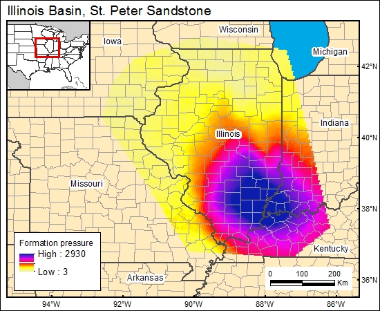
St. Peter Sandstone, Illinois Basin (12b)
Comments on Geologic Parameters
12b CO2 Solubility Brine: Formation Pressure:
There currently is no published information regarding geopressure gradients or maps showing formation-pressure distribution. We used well-completion information from Bell and Kline (1952) to determine the relationship between depth and formation pressure. The data demonstrated a geopressure gradient of about 39.2 psi/100 ft. We used this gradient in combination with the depth to the top of the St. Peter Sandstone to generate a pressure-distribution map for the GIS.
12b Map:

12b Reference:
Bell, A. H., and Kline, V., 1952, Oil and gas development in Illinois during 1951: Illinois Geological Survey, Illinois Petroleum 67, 53 p.


