St. Peter Sandstone, Illinois Basin (12a)
Comments on Geologic Parameters
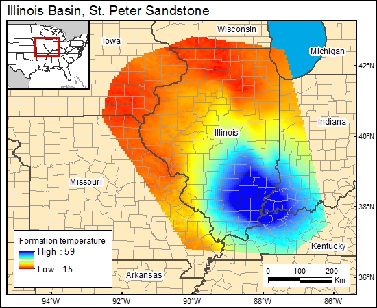
12a CO2 Solubility Brine: Formation Temperature:
Davis (1990) provided geothermal gradients derived from a number of deep wells drilled near the Illinois Basin center. For the five wells, gradients ranged from 0.83 °F/100 ft to 1.27 °F/100 ft, with a mean of 1.03 °F/100 ft. These gradients are slightly less than those of Kinney and others (1976). We used the mean of 1.03 °F/100 ft in combination with the depth to the top of the St. Peter Sandstone to derive a formation temperature distribution map for the GIS.
12a Map:
12a Reference:
Davis, H. G., 1990, Pre-Mississipian hydrocarbon potential of the Illinois Basin, in Leighton, M. W., Kolata, D. R., Oltz, D. F., and Eidel, J. J., eds., Interior cratonic basins: American Association of Petroleum Geologists Memoir 51, p. 473-489.
Kinney, D. M., ed., 1976, Geothermal gradient map of North America: American Association of Petroleum Geologists and U.S. Geological Survey Publication G74014, 2 maps.


