Cape Fear Formation, South Carolina Coastal Plain (03)
Comments on Geologic Parameters
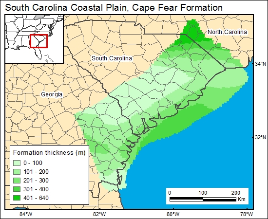
03 Formation Thickness:
There is no published map showing the thickness distribution of the Cape Fear Formation (T. Temples, DOE, Savannah River, personal communication, 2000; B. Hockensmith, South Carolina Department of Natural Resources, personal communication, 2000). Therefore we used the GIS to calculate the difference in elevation at top of the Cape Fear Formation and the top of basement (Colquhoun and others, 1983; Aucott and others, 1987) to calculate a Cape Fear Formation thickness map.
03 Map:
03 Reference:
Aucott, W. R., Davis, M. E., and Speiran, G. K., 1987, Geohydrologic framework of the Coastal Plain aquifers of South Carolina: U.S. Geological Survey, Water-Resources Investigations Report 85-4271, 7 sheets.
Colquhoun, D. J., Woollen, L. D., Van Nienwenhuise, D. S., Padgett, G. G., Oldham, R. W., Boylan, D. C., Bishop, J. W., and Howell, P. D., 1983, Surface and subsurface stratigraphy, structure and aquifers of the South Carolina Coastal Plain: Columbia, SC, State of South Carolina, Office of the Governor, 78 p.


