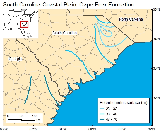
Cape Fear Formation, South Carolina Coastal Plain (11)
Comments on Geologic Parameters
11 Flow Direction:
Several authors have characterized ground-water flow in the Cape Fear interval (Aucott and Speiran, 1985; Miller and others, 1986; Aucott and others, 1987; Aucott, 1988; Miller, 1990). A number of authors determined that the deep aquifers directly below the coast are a marine/terrestrial ground-water interface zone in which waters tend to be stagnant. These studies demonstrate that ground-water flow is parallel to the coast. We chose to use the map of Miller (1990) for the GIS because it is regional in perspective but generally shows the same information for South Carolina that several authors have presented.
11 Map:

11 Reference:
Aucott, W. R., 1988, The pre-development ground-water flow system and hydrologic characteristics of the Coastal Plain aquifers of south Carolina: U.S. Geological Survey, Water-Resources Investigations Report 86–4347, 66 p..
Aucott, W. R., Davis, M. E., and Speiran, G. K., 1987, Geohydrologic framework of the Coastal Plain aquifers of South Carolina: U.S. Geological Survey, Water-Resources Investigations Report 85-4271, 7 sheets.
Aucott, W. R., and Speiran, G. K., 1985, Ground-water flow in the coastal plain aquifers of South Carolina: Ground Water, v. 23, p. 736–745
Miller, J. A., Barker, R. A., and Renkin, R. A., 1986, Hydrology of the Southeastern Coastal Plain Aquifer System, in Vecchioli, J., and Johnson, A. I., eds., Regional aquifer systems of the United States: aquifers of the Atlantic and Gulf Coastal Plain: American Water Resources Association Monograph Series No. 9, p. 53–77.
Miller, J. A., 1990, Ground water atlas of the United States—segment 6, Alabama, Florida, Georgia, and South Carolina: U.S. Geological Survey Hydrologic Investigations Atlas No. HA-730-G, 28 p.


