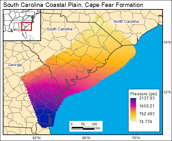
Cape Fear Formation, South Carolina Coastal Plain (12b)
Comments on Geologic Parameters
12b CO2 Solubility Brine: Formation Pressure:
There currently are no published data regarding geopressure gradients or maps showing formation pressures. We used pressure data from Temples and Waddell (1996; their table 3) to generate a graph showing the relationship between pressure and depth. The data show a clear gradient of 0.45 psi/ ft. This gradient was used in conjunction with the depth to top of Cape Fear Formation to derive the formation-pressure distribution map presented in the GIS.
12b Map:

12b Reference:
Temples, T. J., and Waddell, M. G., 1996, Application of petroleum geophysical well logging and sampling techniques for evaluating aquifer characteristics: Ground Water, v. 34, p. 523-531.


