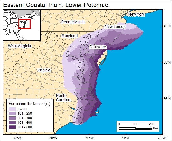
Lower Potomac Group, Eastern Coastal Plain (03)
Comments on Geologic Parameters
03 Formation Thickness:
There is no published map showing the thickness distribution of the lower Potomac aquifer in the eastern coastal plain of New Jersey, Delaware, and Maryland (D. Pope, U.S. Geological Survey, personal communication, 2000). Hansen (1984) provided thickness-distribution information for the Waste Gate Formation in eastern Maryland. We used the GIS to calculate the difference in elevation at top of the lower Potomac aquifer (Trapp and Meisler, 1992) and top of basement (Brown and others, 1972) to calculate lower Potomac aquifer thickness distribution (c3potomacg).
03 Map:

03 Reference:
Brown, P. M., Miller, J. A., and Swain, F. M., 1972, Structural and stratigraphic framework, and spatial distribution of permeability of the Atlantic coastal plain, North Carolina to New York: U.S. Geological Survey, Professional Paper 796, 79 p, 59 plates.
Hansen, H. J., 1984, Hydrogeologic characteristics of the Waste Gate Formation, a new subsurface unit of the Potomac Group underlying the eastern Delmarva Peninsula: Maryland Geological Survey Information Circular 39, 22 p.
Trapp, H., Jr., and Meisler, H., 1992, The regional aquifer underlying the northern Atlantic coastal plain in parts of North Carolina, Virginia, Maryland, Delaware, New Jersey, and New York-summary: U.S. Geological Survey, Professional Paper 1404A, 33 p., 11 plates.


