Pottsville Formation, Black Warrior Basin (01)
Alabama and Mississippi
Comments on Geologic Parameters
01 Depth:
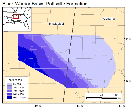
The sequence is deeper to the southwest. The structural map by Borland and Minihan (1977, in Hewitt, 1984), was gridded to represent this property in the GIS data base. We used the DEM generated from National Imagery and Mapping Agency (2000) to calculate and grid the depth to top Pottsville (c1pottsville).
01 Map:
01 Reference:
Hewitt, J., 1984, Geologic overview, coal, and coalbed methane resources of the Black Warrior Basin-Alabama and Mississippi, in Rightmire, C., Eddy, G., and Kirr, J., eds., Coalbed methane resources of the United States: American Association of Petroleum Geologists, Studies in Geology Series 17, p. 73-104.
Pashin, J. C., and others, 1991, Structure, sedimentology, coal quality and hydrology of the Black Warrior Basin in Alabama: controls on the occurrence and producibility of coal methane: The University of Texas at Austin and Geological Survey of Alabama, Bureau of Economic Geology, GRI Contract Number 1544, 187 p.


