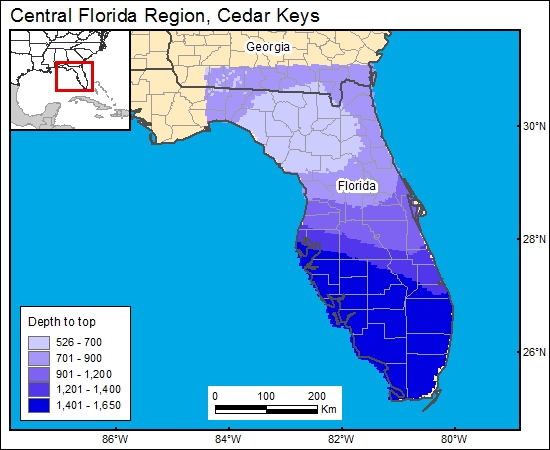
Cedar Keys/Lawson, Central Florida Region (01)
Comments on Geologic Parameters
01 Depth:
In the Polk County Florida area, the lower Cedar Keys and Lawson Dolomites occur between 4005- and 4495-ft depth (J. Haberfeld, Florida Department of Environmental Protection, personal communication, 2000). Chen (1965) presented a map showing the elevation of the top of the Upper Cretaceous, which is the top of the Lawson Dolomite, and we used this map for the GIS. We then used a DEM generated from Digital Terrain Elevation Data (National Imagery and Mapping Agency, 2000) to calculate and grid (c1cedarkeys) the depth to top of the lower Cedar Keys/Lawson Formation
01 Map:

01 Reference:
Chen, S. C., 1965, The regional stratigraphic analysis of Paleocene and Eocene rocks of Florida: Florida Geological Survey Bulletin No. 45, 105 p.
Haberfeld (Florida Department of Environmental Protection, personal communication, 2000)


