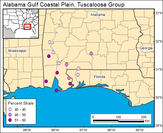
Tuscaloosa Group, Alabama Gulf Coastal Plain (05)
Comments on Geologic Parameters
05 Percent Shale:
There currently is no published map of Tuscaloosa Group percent-shale distribution for the Mobile region (Jack Pashin, Alabama Geological Survey, personal communication, April 2000). We used the geophysical logs from the cross sections of Mancini and others (1987) to generate a semiquantitative estimate of percent shale within the lower Tuscaloosa Group. A large number of geophysical logs that penetrate the Tuscaloosa Group are available. From these logs, it would possible to construct a more accurate shale distribution, if CO2 sequestration in the area becomes a serious possibility.
05 Map:

05 Reference:
Mancini, E. A., Mink, R. M., Payton, J. W., and Bearden, B. L., 1987, Environments of deposition and petroleum geology of the Tuscaloosa Group (Upper Cretaceous), South Carlton and Pollard Fields, southwestern Alabama: American Association of Petroleum Geologists Bulletin, v. 71, p. 1128-1142.


