Tuscaloosa Group, Alabama Gulf Coastal Plain (09)
Comments on Geologic Parameters
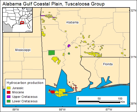
09 Hydrocarbon Production:
There are a limited number of wells producing from the Tuscaloosa Group in southwestern Alabama (Mancini and others, 1987; J. Pashin, Alabama Geological Survey, personal communication, April, 2000). In the Mobile area, a relatively large number of wells have penetrated the Tuscaloosa during the process of drilling to the Jurassic Smackover and Norphlet Formations. The petroleum atlas of southwestern Alabama was used to summarize petroleum wells that produce from or penetrate the Tuscaloosa Group in the Mobile region (Bolin and others, 1989). Because drilling has continued in the Mobile area, especially hydrocarbon production from the Smackover and Norphlet Formations, and because the petroleum atlas (Bolin and others, 1989) does not show dry-well locations, we recommend a more thorough investigation of hydrocarbon exploration and production activity if CO2 sequestration becomes a serious possibility in the area.
09 Map:

09 Reference:
Bolin, D. E., Mann, S. D., Burroughs, D., Moore, H. E., Jr., and Powers, T. J., 1989, Petroleum atlas of southwestern Alabama: Alabama Geological Survey, Atlas 23, 218 p.
Mancini, E. A., Mink, R. M., Payton, J. W., and Bearden, B. L., 1987, Environments of deposition and petroleum geology of the Tuscaloosa Group (Upper Cretaceous), South Carlton and Pollard Fields, southwestern Alabama: American Association of Petroleum Geologists Bulletin, v. 71, p. 1128-1142.


