Tuscaloosa Group, Alabama Gulf Coastal Plain (08)
Comments on Geologic Parameters
08 Continuity of Top Seal:
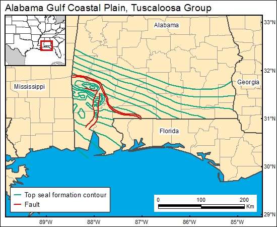
The Selma Chalk is thick and generally impermeable. However, Pashin and others (1998) demonstrated that fault-induced fracturing can greatly enhance fracturing in the Selma interval. Therefore, we used a map showing the configuration of the top of the Selma (Moffett and others, 1984a), which shows the location of major faults, to characterize the continuity of the top seal.
08 Map:

08 Reference:
Moffett, T. B., Hinkle, F., Epsman, M. L., and Wilson, G. V., 1984a, Configuration of the top of the Selma Group in Alabama: Alabama Geological Survey, Map 199CB, 1 sheet.
Pashin, J. C., Raymond, D. E., Rindsberg, A. K., Alabi, G. G., Carroll, R. E., Groshong, R. H., and Jin, G., 1998, Area balance and strain in an extensional fault system: strategies for improved oil recovery in fractured chalk, Gilbertown Field, southwestern Alabama: U.S. Department of Energy Report DOE/PC/91008-20 (DE98000499), National Petroleum Technology Office, 221 p.


