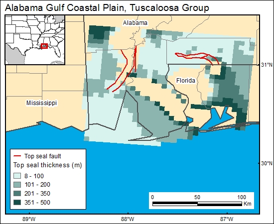
Tuscaloosa Group, Alabama Gulf Coastal Plain (07)
Comments on Geologic Parameters
07 Top Seal Thickness:
The Selma Chalk, which overlies the Tuscaloosa Group is widely recognized as a regional aquiclude. In the Mobile area, it generally ranges in thickness from 300 to 400 m (Raymond and others, 1988; Pashin and others, 1998). There currently is no published thickness map for the Selma Chalk. However, there are published maps of the top of the Selma and Eutaw Formations. (Hinkle and others, 1983; Moffett and others, 1984a). These were gridded and the top Tuscaloosa subtracted to determine the thickness of the Selma Chalk (c7tuscaloosag).
07 Map:

07 Reference:
Hinkle, F., Moffett, T. B., Epsman, M. L., Wilson, G. V., and Moore, J. V., 1983, Configuration of the top of the Eutaw Formation in Alabama: Alabama Geological Survey, Map 199A, 1 sheet.
Moffett, T. B., Hinkle, F., Epsman, M. L., and Wilson, G. V., 1984a, Configuration of the top of the Selma Group in Alabama: Alabama Geological Survey, Map 199CB, 1 sheet.
Pashin, J. C., Raymond, D. E., Rindsberg, A. K., Alabi, G. G., Carroll, R. E., Groshong, R. H., and Jin, G., 1998, Area balance and strain in an extensional fault system: strategies for improved oil recovery in fractured chalk, Gilbertown Field, southwestern Alabama: U.S. Department of Energy Report DOE/PC/91008-20 (DE98000499), National Petroleum Technology Office, 221 p.
Raymond, D. E., Osborne, W. E., Copeland, C. W., and Neathery, T. L., 1988, Alabama stratigraphy: Alabama Geological Survey, Circular 140, 97 p.


